MapToaster Topo/NZ Version 4.0
Our package is being constantly improved. Read on for full details.
The topographic mapping product that we developed was originally sold as TopoMap NZ and TopoMapPro. It has now been integrated into our MapToaster range of products.
If you are a TopoMap Pro user you are a valued customer and are eligible for upgrade pricing. You may have heard that our product is no longer available, that there was no upgrade path for TopoMapPro, or you may have been told that another package was the "successor" to our software. Well our software is still available, there is an upgrade path and we back it great technical support.
How to Upgrade
If you would like to upgrade to version 4 maps or you are a TopoMapPro user, email us at with details of your current version and we'll get back to you with pricing and options.
We need to know:
- whether you have the High-resolution or Standard/Compact version
- whether you have all New Zealand or just one Island?
- your serial number
- for multi-user licences, we will need a copy of the front page of your multi-user licence agreement
New in Version 4
This release is our 4th major revision of the maps of the 1:50,000 topomaps and aerial photos.
The new version includes all of the 1:50,000 topographical maps published up to the start of August 2006. More than 70 map sheets have been updated in this release.
| D44 | Takitimu | 2005 | R11 | Auckland | 2006 | |
| D46 | Riverton / Aparimu | 2004 | R12 | Pukekohe | 2006 | |
| E43 | Eyre | 2006 | R13 | Port Waikato | 2004 | |
| E45 | Winton | 2004 | R16 | Marokopa | 2005 | |
| F40 | Wanaka | 2006 | R17 | Awakino | 2004 | |
| F41 | Arrowtown | 2004 | R22 | Wanganui | 2004 | |
| F43 | Garvie | 2006 | R23 | Marton | 2005 | |
| F44 | Waikaia | 2004 | R26 | Paraparaumu | 2006 | |
| G40 | Lindis | 2004 | R27 | Wellington | 2006 | |
| G41 | Cromwell | 2006 | R28 | Wellington | 2006 | |
| G42 | Alexandra | 2005 | S10 | Hauraki Gulf | 2006 | |
| G44 | Beaumont | 2004 | S11 | Waiheke | 2006 | |
| G45 | Tapanui | 2004 | S12 | Maramarua | 2006 | |
| G47 | Tautuku | 2004 | S13 | Huntly | 2005 | |
| H41 | Ranfurly | 2004 | S16 | Te Kuiti | 2004 | |
| H44 | Lawrence | 2006 | S17 | Mangapehi | 2004 | |
| I42 | Dunback | 2005 | S18 | Taumarunui | 2005 | |
| J42 | Hampden & Palmerston | 2004 | S23 | Marton | 2005 | |
| J43 | Hampden & Palmerston | 2004 | S24 | Foxton | 2005 | |
| K30 | Punakaiki | 2004 | S26 | Carterton | 2005 | |
| K36 | Methven | 2006 | T09 | Cuvier | 2005 | |
| K37 | Hinds | 2005 | T10 | Coromandel | 2005 | |
| M02 | North Cape | 2006 | T11 | Whitianga | 2005 | |
| M35 | Christchurch | 2004 | T12 | Thames | 2005 | |
| N02 | North Cape | 2006 | T18 | Kuratau | 2005 | |
| N26 | Takaka | 2005 | T19 | Tongariro | 2006 | |
| N29 | St Arnaud | 2005 | T26 | Masterton | 2006 | |
| O27 | Nelson | 2006 | U10 | Coromandel | 2005 | |
| O28 | Wairau | 2006 | U14 | Tauranga | 2005 | |
| O29 | Waihopai | 2006 | U15 | Ngongotaha | 2006 | |
| P21 | Manaia | 2006 | U20 | Kaweka | 2006 | |
| P28 | Blenheim | 2005 | U21 | Kereru | 2005 | |
| Q11 | Waitakere | 2006 | V15 | Edgecumbe | 2004 | |
| Q12 | Pukekohe | 2006 | V20 | Esk | 2005 | |
| Q19 | Waitara | 2004 | W13 | Whakatane | 2005 | |
| Q21 | Hawera | 2004 | W14 | Whakatane | 2005 | |
| Q27 | Cook Strait | 2006 | W15 | Whakatane | 2005 | |
| Q27 | Wellington | 2006 | W19 | Mohaka | 2006 | |
| R10 | Whangaparaoa | 2006 | Y18 | Gisborne | 2006 |
The LINZ aerial photography from 2004-2006 has also been added. This adds new sheets and full/partial updates of 250 quarter-sheets out of a total of about 750. See the aerial photo page for coverage maps and list of towns.
Version 4 is primarily a map upgrade - we continue our policy of providing incremental software updates and bug fixes as a free download from the website.
New in Version 3
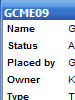 |
Geocaching Pocket Query Support MapToaster Topo now supports GPX files with the geocaching.com Pocket Query extensions. The caches are shown with the icon coloured by cache type. When you double-click on a geocache icon on the map, a window opens that shows the full detail of the cache. Great for managing your cache info and taking it out in the field. |
 |
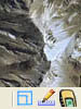
Aerial Photos Overlaid with Transparent Topographical Maps If you have Topo/NZ and NZAirPhoto, this new feature combines the rich detail of aerial photography with the information content of the topographic maps, to give an unprecedented view of the terrain. More... |
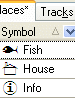 |
Improved MyPlaces makes creating maintaining sets of Places waypoints much easier
|
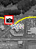 |
Automatically Link Digital Photos to the Map You can now use your GPS track log to automatically link digital photos to the map. The Autolinking features enables you to create Places (waypoints) for each of the photographs from your digital camera. To view the images you can double-click on the icon on the map, or access them via MyPlaces. |
 |
Geographic Internet Searches Simply right-click on the map and select the web service that you want to search. You can use www.geocaching.com to find nearby geocaches and GeoURL to search for web sites in the vicinty. You can configure MapToaster to search any webservice that understands geographic location. |
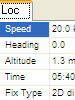 |
Realtime GPS Tracking Display When real-time tracking is enabled, a new floating status window is shown. The realtime tracking window provides a view of the GPS data when the GPS cannot be seen, of if you have a GPS unit with no display of its own. This window displays the current location, speed, direction etc. You can also select a Place to navigate to - the heading and distance to this point will then be shown. If you are using a NMEA GPS for tracking, a sky view of the satellite positions is available. You also have the option of capturing the track into MyPlaces. This features shows where you have been and also allows track gaps with GPS units that have no track capture facilty. |
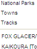 |
Navigation Favourites "learns" the places that you search for most often. The favorites menu also has sub-menus with common accessed locatuons, such as towns, national parks etc. These sub-menus are fully cutomisablw with the locations that are important to you. |
 |
And many others.... The many other additions and refinements include
|
What's new in Version 2.7
- Updated maps and aerial photography - over 80 new maps sheets since the release of TopoMapPro 2..
- Upload Tracks to your GPS.
- Create Tracks by drawing on the screen and then upload to your GPS.
- Supports latest Garmin GPS models, including the Gecko.
- Saved images are now geo-referenced for use in MapInfo, ArcView, AutoCAD etc.
- Can import files from selected dataloggers.
- Add support for COM ports up to COM50 to allow use with USB serial adapters
- Display coordinates in the new New Zealand Transverse Mercator projection
- New network licence allows the software to be installed on a network server.