MapToaster Topo Maps for iPhone and iPad
 MapToaster for iPad and iPhone is available now, providing detailed topographical maps wherever you go.
The app is a free download from the Apple App Store, and
includes a 1:250,000 scale topographical map of New Zealand.
MapToaster for iPad and iPhone is available now, providing detailed topographical maps wherever you go.
The app is a free download from the Apple App Store, and
includes a 1:250,000 scale topographical map of New Zealand.
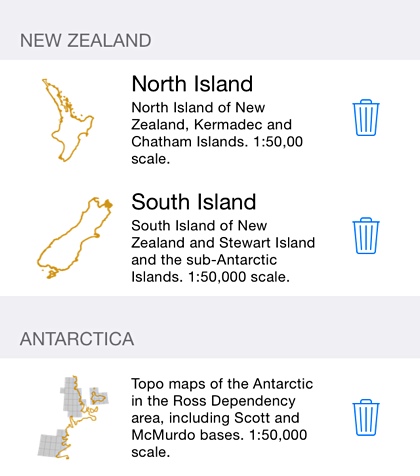
1:50,000 scale topo maps are available for in-app purchase and these include:
- New Zealand South Island and Stewart Island
- New Zealand North Island, Kermadec group and Chatham Islands
- The NZ sub-antarctic islands - Antipodes Is, Auckland Is, Bounty Is, Campbell Is, Snares Is, Antarctica around the area of the Ross Sea
|
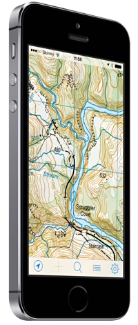
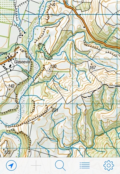
MapToaster for iPhone and iPad combines easy-to-use software with all the rich detail of the Land Information New Zealand topographical maps, helping you to plan your expedition and get to the right spot. The maps are stored on your device, so once downloaded, the mapping doesn't need a WiFi connection or cellphone coverage. Use latitude/longitude coordinates, or the familiar local map coordinate system, e.g. NZTM. | |
|
Buy maps. Use the built-in map store to get the detailed 1:50,000 mapping that you need. Once downloaded, the maps are stored on your device, so you don't need an Internet connection to use them. Keep in mind that the maps are quite large downloads, so they do take a while to install. You need only purchase the mapping once, for all your devices. Once you have made the initial purchase, the maps are a free download on other devices that you own. And if you ever need to delete a map to free up space on your device, you can restore it later at no cost. Maps updated November 2024 |
|
|
Familiar map gestures:
|
|
|
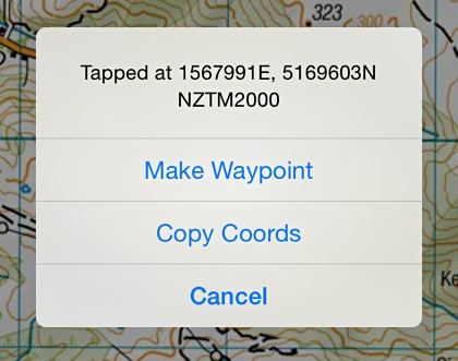
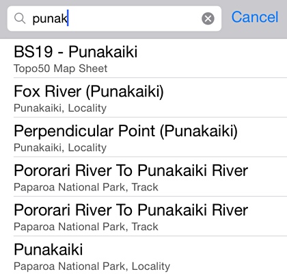
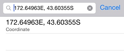
Comprehensive search index has over 50,000 placenames. Search for any of the places marked on the map and DOC track start and end points. Locality names are aligned with those used by government, emergency services and NZPost. The search results show the locality and type of place found. The Find box can also be used to center the map on a coordinate. You can use projected coordinates, such as NZTM, or longitude/latitude in any of the common formats. Here's some examples of how they can be entered:
|
|
|
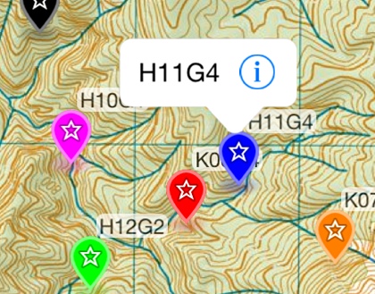
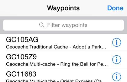
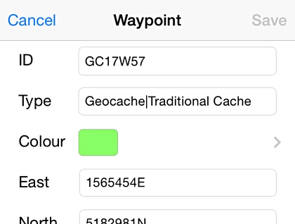
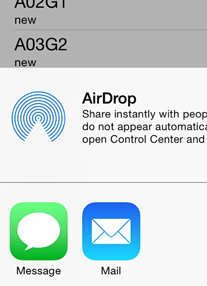
Waypoints. Mark places of interest on the map as you go, or load points of interest before your trip. Tap on a waypoint to see more detail and make changes to the waypoint. Use the Options menu to turn waypoints and waypoint labels on or off. As you zoom out, labelling automatically switches off to avoid clutter. Tap an entry on the waypoint list screen to centre the map on that waypoint. Tap the info button to view the waypoint detail. You can send all your waypoints as a GPX file in an email, iMessage or via AirDrop. New waypoints names can be automatically generated, for speed waypoint capture. The autogenerated waypoint names have a configurable prefix which helps keep your waypoints organised. To add waypoints:
|
|
|
Edit Waypoints. Use the waypoint detail screen to look at waypoint details and to make changes. The share button lets you send a single waypoint by email, iMessage or AirDrop. Tap-and-hold a waypoint till it bounces. You can then drag it to a new location. Makes it easy to get right on the target. |
|
|
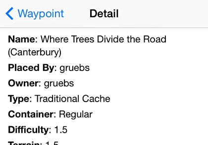
Extra detail. Some GPX files contain additional detail that you can display. If you go geocaching, you can load PocketQuery files from geocaching.com. These contain geocache details and logs. On the waypoint detail screen, click the "View attached detail" and "View linked web page" buttons to see the extra cache information. PocketQuery waypoint marks are automatically coloured by cache type. If you use MapToaster Topo/NZ for Windows and import Shape files, then save them as a GPX file, use the "View attached detail" to see the attribute data from the Shape file. |
|
|
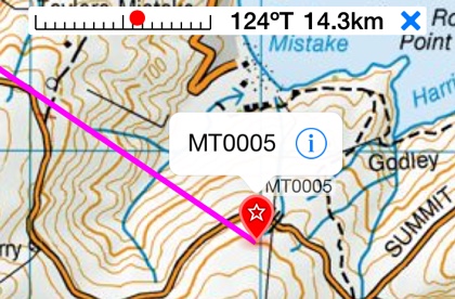
Navigate to a waypoint. Tap on a waypoint and select Navigate to waypoint from the menu. The navigation bar at the top of the window shows the distance and direction to turn to get to the selected waypoint. |
|
|
Share waypoints. Use the share button on the waypoint list or detail screens to send waypoints by email, iMessage or AirDrop. The waypoints are sent as an industry-standard GPX file. Privacy friendly. The app doesn't report your location to us and your waypoints stay on your device, unless you choose to share them |
|
Apple, the Apple logo, iMessage, AirDrop, iPad, iPod, and iPhone are trademarks of Apple Inc., registered in the U.S. and other countries. App Store is a service mark of Apple Inc.